Per què el cel és blau

i els núvols són blancs?

Archive for the ‘2. Recerca’ Category

El paper dels aerosols en el sistema climàtic: II Poland-AOD Conference

Posted by Costa M. a 8 Octubre 2015


Del 7 al 9 d’Octubre s’han portat a terme les Segones Conferències Científiques Nacionals de la Xarxa per a la Investigació dels Aerosols (Poland-AOD) a l’Institut de Oceanologia de l’Acadèmia Polonesa de Ciències (IO-PAN), a la localitat de Sopot (nord de Polònia), per tal de discutir el paper dels aerosols en el sistema climàtic. També han participat a les conferencies la Universitat de Varsòvia, la Universitat Tecnològica de Varsòvia, la Universitat Nicolaus Copernicus de Torun, el Centre de la Fundació Estudi Polar Ekoprognoza i el Consorci GeoPlanet, en cooperació amb Sopockie Societat Científica i l’empresa TodayWeHave.

iopan_logopolan-aodlogo-uw


La conferència s’ha organitzat segons les següent sessions:

  1. L’activitat de recerca de la xarxa Poland-AOD
  2. Mètodes moderns per a la mesura de les propietats físiques dels aerosols
  3. Tècniques Lidar aplicades a la recerca en els estudis de les propietats òptiques i processos físics en l’atmosfera
  4. Els canvis en la radiació solar espai-temporal
  5. Propietats òptiques de la radiació i microfísica de l’”smog” a l’Àrtic
  6. Modelització del transport de contaminants
  7. Les propietats òptiques d’aerosol atmosfèric
  8. Els processos físics que ocorren en l’atmosfera

La meva contribució a la conferència ha estat en primer lloc a la secció relacionada amb mètodes moderns per a la mesura de les propietats físiques dels aerosols, amb la xerrada que porta per títol:

‘Càlcul de fluxos a partir del mètode de covariancia “Eddy” aplicat a mesures de “carbó negre” fetes amb micro-aethalometre AE-51’ (‘Eddy covariance flux calculation method applied to micro-aethaelometer AE-51 black carbon measurements’). Autors: Montserrat Costa-Surós, Krzysztof M. Markowicz.

I en segon lloc amb la presentació a la sessió relacionada amb tècniques Lidar aplicades a la recerca en els estudis de les propietats òptiques i processos físics en l’atmosfera:

‘Aproximacions a la calibració de mesures automàtiques de ” ratis de mescla de vapor d’aigua”  fetes amb un lidar tipus Raman a llarg termini” (‘Calibration approximations for automated long term water vapor mixing ratio retrievals from a Raman lidar’). Autors: Montserrat Costa-Surós, Iwona S. Stachlewska, Krzysztof M. Markowicz.

foto_sopot

Font: Wikimedia Commons

Més informació:

The Institute of Oceanology of the Polish Academy of Sciences (IO PAN)

Poland-AOD Network

Institute of Geophysics – University of Warsaw (IGF-UW)

Posted in 1. Ciència, 2. Recerca, 5. Noticia | Etiquetat: , , , , , , , , , , , , , , , , , , , , , , | Leave a Comment »

ICCP 2012

Posted by Costa M. a 18 Juliol 2012


El pròxim congrés al què assistiré és el “6th International Conference on Clouds and Precipitation”, ICCP-2012. Es portarà a terme a Leipzig, Alemanya, del 30 de juliol al 3 d’agost de 2012.

Aquest congrés s’organitza cada 4 anys per la Comissió Internacional de Núvols i Precipitació (International Commission on Clouds and Precipitation), la qual forma part de l’Associació Internacional de Meteorologia i Ciències de l’Atmosfera (International Association of Meteorology and Atmospheric Sciences, IAMAS). L’objectiu del congrés és el de promoure presentacions de recerca científica en l’àrea dels núvols i la precipitació, així com motivar l’intercanvi d’idees entre la comunitat internacional.

Els temes que es tractaran van des d’estudis de modelització teòrica, observacional i numèrics de la física de núvols i la precipitació, fins a la química i la dinàmica física dels núvols.

El programa preliminar inclou sessions sobre:

  • Física bàsica dels núvols i de la precipitació
  • Capes límit dels núvols calentes
  • Els núvols convectius (incloent l’electrificació de núvols)
  • Núvols de fase mixta (incloent els núvols stratus de nivell mitjà de l’Àrtic)
  • Núvols tipus cirrus
  • Núvols orogràfics
  • Sistemes de núvols de mesoescala (inclou tempestes severes)
  • Interaccions entre els aerosols, els núvols i la precipitació
  • Els núvols i el clima (incloent propietats radiatives dels núvols)
  • Nuclis de gel i nuclis de condensació
  • Química dels núvols i la precipitació
  • Tècniques de mesura de propietats dels núvols i de la precipitació
  • Aplicacions de la física dels núvols i la precipitació

Més informació a la web de l’esdeveniment: ICCP 2012 Leipzig

Posted in 1. Ciència, 2. Recerca | Etiquetat: , , , , , , | 1 Comment »

Cantabria Campus Nobel

Posted by Costa M. a 12 Juny 2012


“5 días. 3 premios Nobel. 50 científicos excepcionales. 100 jóvenes y brillantes investigadores. Una pasión: el mundo de la ciencia en una región del conocimiento.”

Aquest és el lema del Cantabria Campus Nobel (CCN) que s’està donant lloc durant aquesta setmana (de l’11 al 15 de juny de 2012) a Santander. Es tracta d’una trobada internacional única destinada a impulsar els límits el coneixement sobre la base del pensament col·lectiu, l’anàlisi rigurós i l’internanvi d’experiències innovadores.

A la web www.cantabriacampusnobel.es podreu trobar els videos de les conferències que ja han tingut lloc, la retransmissió en directe en les hores d’emissió (matins), el blog i el programa complet, entre altres coses.

Personalment, tinc l’orgull de poder dir que l’amiga i companya Sandra Ricart Casadevall (blog), doctorant en Ciències Experimentals i Sostenibilitat de la UdG, ha rebut una beca per assistir al Cantabria Campus Nobel. D’entre centenars d’estudiants que han sol·licitat una d’aquestes beques, ella i tres altres estudiants de la Universitat de Girona, han estat seleccionades per participar en aquest esdeveniment acadèmic que compta amb la participació de varis Premis Nobel i d’altres personalitats de prestigi del món científic. A més, la satisfacció de la UdG ha estat tan gran que els subencionarà el viatge fins a Santander.

Posted in 1. Ciència, 2. Recerca | 1 Comment »

Nova experiència: Finlandia!

Posted by Costa M. a 19 gener 2012


Properament tindré la oportunitat de fer una estada breu gràcies a una beca del Ministeri a la seu central de l’empresa VAISALA a Vantaa, a pocs kilòmetres de Helsinki.

Vaisala és una empresa líder mundial en mesuraments ambientals i industrials. Amb més de 70 anys d’experiència,  segons la seva web, Vaisala contribueix a millorar la qualitat de vida, en proporcionar una àmplia gamma d’innovadors productes i serveis d’observació i mesurament per meteorologia, operacions crítiques de meteorologia i ambients controlats. L’empresa atén a clients en més de 140 països.

Amb seu a Finlàndia, el Grup dóna feina a més de 1350 professionals arreu del món. L’empresa té oficines i operacions a Finlàndia, Amèrica del Nord, França, Regne Unit, Alemanya, Índia, Xina, Suècia, Unió dels Emirats Àrabs Units, Malàisia, Japó i Austràlia.

Els negocis de Vaisala es distingeixen per la seva tecnologia avançada, desenvolupament i investigació, dinàmica i un alt grau d’especialització.

L’empresa s’organitza a partir de tres divisions: Meteorologia, Operacions crítiques de meteorologia i Ambients controlats. En concret, dóna servei a clients professionals de la meteorologia a través d’ofertes integrals per a les seves mesures, maneig de dades i necessitats d’advertències anticipades. Les Operacions crítiques meteorològiques es centren en clients com aeroports, carreteres, defensa i meteorologia crítica en el sector de l’energia. Proporciona productes i solucions per a donar suport a les decisions operatives dels clients fetes sota qualsevol condició climàtica. Ambients controlats dóna servei a clients industrials en l’automatització d’edificis, en el sector de la biologia i l’alta tecnologia, així com en sectors d’aplicacions industrials específiques. Ofereix una àmplia gamma d’instruments industrials per garantir la qualitat i productivitat operatives.

S’accepten comentaris, recomanacions, etc…

Posted in 2. Recerca | Leave a Comment »

Effect of cloud-scattered sunlight on earth’s energy balance depends on wavelength of light

Posted by Costa M. a 4 Mai 2011


Accounting for wavelength effects will likely improve climate models


RICHLAND, Wash. – Atmospheric scientists trying to pin down how clouds curb the amount of sunlight available to warm the earth have found that it depends on the wavelength of sunlight being measured. This unexpected result will help researchers improve how they portray clouds in climate models.

Additionally, the researchers found that sunlight scattered by clouds — the reason why beachgoers can get sunburned on overcast days — is an important component of cloud contributions to the earth’s energy balance. Capturing such contributions will increase the accuracy of climate models, the team from the Department of Energy’s Pacific Northwest National Laboratory reported in Geophysical Research Letters earlier this month.

“The amount of the sun’s energy that reaches the earth’s surface is the main driver of the earth’s temperature. Clouds are one of the least understood aspects of climate change. They can block the sun, but light can also bounce off one cloud into another cloud’s shadow and increase the solar energy hitting earth,” said PNNL atmospheric scientist Evgueni Kassianov.


Cloudy Dissonance

Cloudy dissonance: These cumulus clouds above Oklahoma both shade the earth and make shadows brighter. The larger ones have a distinct cauliflower shape, providing even more opportunities for light to bounce off of them.

White clouds

Clouds both cool down and warm up the earth’s surface. They cool the earth by reflecting some sunlight up into outer space, and they warm it by bouncing some sunlight down to the surface. Overall, most clouds have a net cooling effect, but atmospheric scientists need to accurately measure when they cool and warm to produce better climate models that incorporate clouds faithfully.

But it’s a hard number to get. Fair-weather clouds are big puffy white objects that bounce a lot of light around. They can make the sky around them look brighter when they’re there, but they float about and reform constantly. Cloud droplets and aerosol particles in the sky — tiny bits of dirt and water in the air that cause haziness — scatter light in three dimensions, even into cloud shadows.

To determine the net cloud effect, researchers need two numbers. First they need to measure the total amount of sunlight in a cloudy sky. Then they need to determine how bright that sky would be without the clouds, imagining that same sky to be blue and cloudless, when aerosols are in charge of a sky’s brightness. The difference between those numbers is the net cloud effect.

Rainbow energy

Researchers have traditionally estimated the net cloud effect by measuring a broad spectrum of sunlight that makes it to the earth’s surface, from ultraviolet to infrared. But clouds are white — that’s because the large water droplets within them scatter light of all colors almost equally in the visible spectrum, the part of the electromagnetic spectrum that includes the colors of the rainbow.

On the other hand, aerosols — both within clouds and in the open sky — bounce different-colored light unequally. Broadband measurements that fail to distinguish color differences might be covering up important details, the researchers thought.

Instead of taking one broadband measurement that covers everything from ultraviolet to infrared, Kassianov and crew wanted to determine how individual wavelengths contribute to the net cloud effect. To do so, the team used an instrument that can measure brightness at four different wavelengths of color — violet, green, orange, red — and two of infrared.

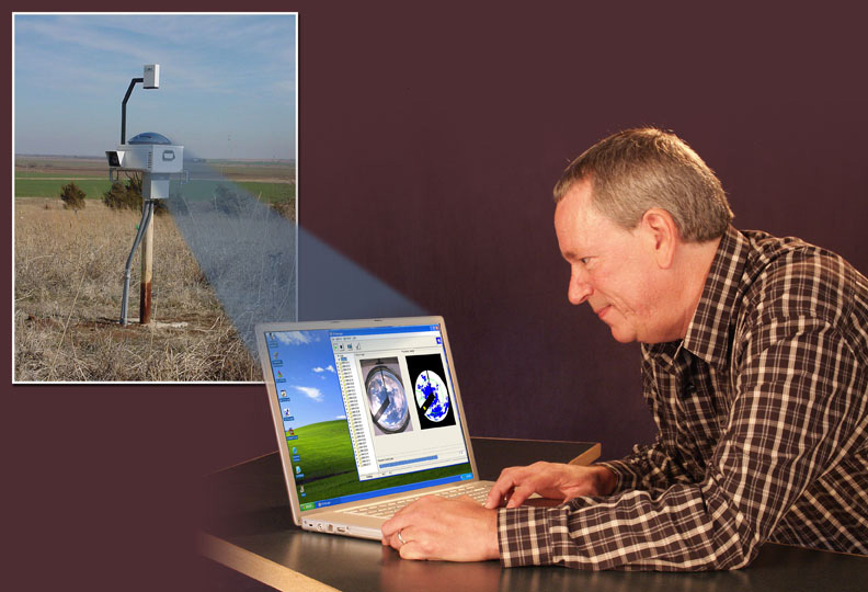
In addition, this instrument, a spectral radiometer at DOE’s Atmospheric Radiation Measurement Climate Research Facility located on the southern Great Plains in Oklahoma, allowed the team to calculate what the brightness would be if the day sported a cloudless, blue sky. The spectral measurements taken by the radiometer can be converted into the amount and properties of aerosols. Then aerosol properties can be used to calculate clear blue sky brightness.

Clouds Gone Wild

Comparing measured values for cloudy sky to the calculated values for clear sky, the researchers found that, on average, puffy fair-weather clouds cool down the earth’s surface by several percent on a summer day. Although clouds cool overall, two components that the researchers looked at — from direct and scattered sunlight — had opposite effects.

The direct component accounts for the shade provided by clouds and cools the earth. The second component accounts for the sunlight scattered between and under clouds, which makes the sky brighter, warming the earth.

“The sunlight scattered by clouds can heat the surface,” said Kassianov. “We all know that we can still get sunburned on cloudy days. This explains why.”

In the Oklahoma summer, the scattered-light effect measured by the researchers could be quite large. For example, if a cloud passed over the instrument, the measured cloudy sky brightness exceeded calculated clear sky value by up to 30 percent. Kassianov attributes that large difference to scattered sunlight being “caught on tape” by the radiometer.

“Sunlight scattered by three-dimensional, irregular clouds is responsible for the observed large difference. The one-dimensional cloud simulations currently used in large-scale climate models don’t capture this diffuse light,” said Kassianov.

Aerosols’ Day in the Sky

The team also found that the effect changed depending on the measured visible-spectrum wavelength, and whether the light was direct or scattered.

With direct light, the cooling caused by clouds was weakest on the violet end of the spectrum and strongest at infrared. With scattered light, warming caused by clouds was also weakest at violet and the strongest at infrared. Overall, the least cooling and warming occurred at violet, and the most cooling and warming occurred at infrared.

Because large droplets in clouds scatter sunlight almost uniformly across the spectrum, the clouds themselves can’t be the reason why different wavelengths contribute differently to the net cloud effect. Compared to cloud droplets, aerosols are more than 100 times smaller and scatter wavelengths differently. These results suggest that aerosols — which not only cause haziness but contribute to cloud formation as well — are responsible for the wavelength differences, something researchers need to be aware of as they study clouds in the sky.

“If you want to study how aerosols and clouds interact,” said Kassianov, “you need to look in the region of the spectrum where aerosol effects are significant. If you want to fish, you go where the fish are biting.”


Reference: Kassianov E., Barnard J., Berg L.K., Long C.N., and C. Flynn, Shortwave Spectral Radiative Forcing of Cumulus Clouds from Surface Observations, Geophys Res Lett, April 2, 2011, DOI 10.1029/2010GL046282.

 This work was supported by the U.S. Department of Energy Office of Science.

Tags: Environment, Fundamental Science, Climate Change, Atmospheric Science

Pacific Northwest National Laboratory is a Department of Energy Office of Science national laboratory where interdisciplinary teams advance science and technology and deliver solutions to America’s most intractable problems in energy, the environment and national security. PNNL employs 4,900 staff, has an annual budget of nearly $1.1 billion, and has been managed by Ohio-based Battelle since the lab’s inception in 1965. Follow PNNL on Facebook, LinkedIn and Twitter.

Article from: Mary Beckman, PNNL, (509) 375-3688 (April 22, 2011)

Posted in 1. Ciència, 2. Recerca | Leave a Comment »

European Geosciences Union 2011

Posted by Costa M. a 19 Març 2011


L’assamblea General de l’EGU cada any reuneix geocientífics d’arreu del món en un seguit de reunions que cobreixen totes les disciplines de la Terra, ciències planetàries i espacials.

És especialment important per als joves científics ja que les crides de l’EGU per proporcionar un fòrum on presentar els seus treballs i discutir les seves idees amb experts en tots els camps de les geociències és un escenari immillorable.

Aquest any, com ja es ve fent els últims anys, tindrà lloc a Viena (Àustria) del 3 al 8 d’abril.

Per a més informació: http://meetings.copernicus.org/egu2011/

Posted in 2. Recerca, 5. Noticia | Leave a Comment »

PNNL: Pacific Northwest National Laboratory

Posted by Costa M. a 2 Març 2011


I want to tell you some things about this Research Laboratory that I’m staying in a brief stay for four months.

It is located in Richland, on the sunny eastern side of Washington state. PNNL is one of the U.S. Department of Energy’s (DOE’s) ten national laboratories, managed by DOE’s Office of Science. PNNL also performs research for other DOE offices as well as government agencies, universities, and industry to deliver breakthrough science and technology to meet today’s key national needs.

The Laboratory

  • provides the facilities, unique scientific equipment, and world-renowned scientists/engineers to strengthen U.S. scientific foundations for fundamental research and innovation
  • prevents and counters acts of terrorism through applied research in information analysis, cyber security, and the non-proliferation of weapons of mass destruction
  • increases U.S. energy capacity and reduces dependence on imported oil through research of hydrogen and biomass-based fuels
  • reduces the effects of energy generation and use on the environment.

PNNL currently has approximately 4,900 staff members and a business volume of more than $1.1 billion. The William R. Wiley Environmental Molecular Sciences Laboratory, a DOE Office of Science national scientific user facility, is located on PNNL’s Richland campus. PNNL operates a marine research facility in Sequim, and has satellite offices in Seattle and Tacoma, Washington; Portland, Oregon; and Washington, D.C.

Battelle has operated PNNL for DOE and its predecessors since 1965. A unique feature of Battelle’s contract with DOE allows the staff to work for private industry. To learn more about PNNL, see the video, Advancing Transformational Science and Technology on PNNL’s YouTube channel and read the transcript.


Concretly, I’m in the Fundamental & Computational Sciences Directorate, at the Atmospheric Science & Global Change Division and in the Climate Physics Group.

This challenge is addressed by a combination of field measurements and modeling as part of the DOE Atmospheric Radiation Measurement program.

Climate and Cloud Physics

Global Climate modeling can be enhanced by the use of satellite and surface field measurements. Pacific Northwest National Laboratory researcher Chuck Long (my mentor) has developed the Total Sky Imager to remotely provide vital field measurements in real time. TSI uses a digital camera to collect hemispheric ”fish eye” images of the sky, which are then processed to infer what amount of the sky contains clouds at the monitored site.
  • Modeling research on cloud and radiative processes.
  • Data analysis and cloud property retrievals from ground-based remote sensing systems.
  • Aerosol and cloud property retrievals from satellite-based instrumentation.
  • Develop new process parameterization schemes for community climate models.
  • Develop and evaluate new high-resolution global climate models.
  • Develop instrumentation and conduct field observations for improving understanding of cloud processes and effects.

Much of the uncertainty in projections of global climate change is due to the complexity of clouds, aerosols, and cloud-aerosol interactions, and the difficulty of representing them in climate models. This challenge is addressed by a combination of field measurements and modeling as part of the DOE Atmospheric Radiation Measurement program. Improved instrumentation and methods for determining cloud and aerosol properties from surface and satellite measurements are developed. These retrievals are used to evaluate the clouds and aerosols simulated by global climate models. The evaluation guides further development of the cloud and aerosol parameterizations for the global climate models.


For more information, visit the website: http://www.pnl.gov/

Posted in 2. Recerca | 2 Comments »

El Programa de Medición de Radiación Atmosférica (ARM Program)

Posted by Costa M. a 27 Octubre 2010


El Atmospheric Radiation Measurement (ARM) es un Programa Nacional del Departamento de Energía de los EE.UU. (DOE) destinado al estudio del cambio climático global a cargo de la comunidad científica nacional e internacional. Consiste en una red de estaciones terrestres altamente instrumentada, instalaciones móviles y aéreas, y una gran base de datos. El ARM colabora ampliamente con otros laboratorios, organismos, universidades y empresas privadas en la recopilación y el intercambio de datos. Algunos de los colaboradores de ARM son los laboratorios del DOE, la National Oceanic and Atmospheric Administration (NOAA), la National Atmospheric and Spatial Administration (NASA), el Programa de Predicción del Cambio Climático, y muchos otros centros estadounidenses y universidades internacionales.

El ARM fue creado en 1989 para desarrollar algunos de los sistemas instrumentados de las estaciones terrestres y para estudiar los procesos de formación de nubes y su influencia en la transferencia radiativa. Esta infraestructura científica ahora incluye también un sistema para archivar los datos disponibles para su uso por parte de los científicos de todo el mundo a través del Servicio para la Investigación del Clima (Climate Research Facility).

El ARM Climate Research Facility es un servicio ofrecido por el DOE para el estudio del cambio global por la comunidad científica nacional e internacional. La investigación en esta área incluye el estudio de las alteraciones del clima, productividad de la tierra, de los océanos u otros recursos hídricos, la química atmosférica, y los sistemas ecológicos que pueden alterar la capacidad de la Tierra para sustentar la vida. La investigación del cambio global también incluye el estudio, seguimiento, evaluación, predicción, y las actividades de gestión de la información para describir y comprender:

–          La interactividad entre la física, la química y los procesos biológicos que regulan el sistema Tierra en su conjunto.

–          El ambiente único que ofrece la Tierra para la vida.

–          Los cambios que se están produciendo en el sistema Tierra y el medio ambiente, y cómo estos cambios se ven influenciados por las acciones humanas.


El objetivo principal del Programa ARM es incrementar el conocimiento de la interacción entre las nubes y los flujos radiativos atmosféricos, además de incorporar este conocimiento  en la mejora de los modelos climáticos. Desde una perspectiva observacional, el ARM se centra la obtención de mediciones continuas de campo de los flujos radiativos solar e infrarrojo térmico en la superficie de la Tierra, y todas las cantidades de la atmósfera que afectan estos flujos (Ackerman, T. and Stokes, G. 2003).


El ARM ha sido el primer programa de investigación sobre el clima en implementar un conjunto de instrumentos de vanguardia para la obtención de mediciones continuas de las nubes y propiedades de los aerosoles. Esta estrategia ha revolucionado la capacidad de recoger estadísticas a largo plazo de las propiedades detalladas de las nubes y ahora sirve de modelo para programas en todo el mundo.


El ARM ha formado relaciones muy importantes. Por un lado, ha hecho estrechas colaboraciones con centros de predicción meteorológica operacional. Los centros meteorológicos han encontrado que los datos de ARM son extremadamente útiles para la evaluación y la mejora de sus propios modelos. Y a su vez, han suministrado apoyo a la investigación e ideas para la comunidad ARM. El ARM Climate Research Facility se ha convertido en una parte integral de la colaboración internacional y de los programas de investigación patrocinados por el gobierno EE.UU. por organismos como la NASA y la NOAA. Este interés en todo el mundo predice un futuro exitoso para la teledetección de base en tierra para el modelado del clima y los pronósticos meteorológicos.


Además, actualmente las instalaciones e instrumental con el que cuenta el Programa ARM son las mayores y más importantes del mundo en lo que se refiere a investigación del clima sobre el terreno.


Pàgina web de l’ARM: http://www.arm.gov/


Más información bibliográfica de interés sobre el ARM Program:

–       Ackerman, T. and Stokes, G. 2003. The Atmospheric Radiation Measurement program (vol 56, pg 38, 2003). Phys Today, 56, 38-44.

–       Campbell, J., Hlavka, D., Welton, E., Flynn, C., Turner, D. and Spinhirne, J. 2002. Full-time, eye-safe cloud and aerosol lidar observation at atmospheric radiation measurement program sites: Instruments and data processing. J.Atmos.Ocean.Technol., 19, 431-442.

–       Clothiaux, E., Moran, K., Martner, B., Ackerman, T., Mace, G. and Uttal, T. 1999. The atmospheric radiation measurement program cloud radars: Operational modes. J.Atmos.Ocean.Technol., 16, 819-827.

–       Clothiaux, E., Ackerman, T., Mace, G., Moran, K., Marchand, R. and Miller, M. 2000. Objective determination of cloud heights and radar reflectivities using a combination of active remote sensors at the ARM CART sites. J.Appl.Meteorol., 39, 645-665.

–       Soden, B., Turner, D., Lesht, B. and Miloshevich, L. 2004. An analysis of satellite, radiosonde, and lidar observations of upper tropospheric water vapor from the Atmospheric Radiation Measurement Program. Journal of geophysical research, 109, 1-19.

–       Turner, D. and Goldsmith, J. 1999. Twenty-four-hour Raman lidar water vapor measurements during the Atmospheric radiation Measurement program’s 1996 and 1997 water vapor intensive observation periods. J.Atmos.Ocean.Technol., 16, 1062-1076.

–       van Zadelhoff, G., Donovan, D., Baltink, H. and Boers, R. 2004. Comparing ice cloud microphysical properties using CloudNET and atmospheric radiation measurement program data. Journal of geophysical research, 109, 1-15.


Posted in 2. Recerca | Leave a Comment »

AuroraMax, utilitat Online per a Veure Aurores Boreals en directe

Posted by Costa M. a 27 Setembre 2010


L’Agència Espacial Canadenca ha desenvolupat un sorprenent servei de webcam a través del qual es pot observar en directe les impressionants Aurores Boreals que es formen al nord del país …

http://www.asc-csa.gc.ca/fra/astronomie/auroramax/connecter.asp

Posted in 2. Recerca | Leave a Comment »

Què és un doctorat?

Posted by Costa M. a 14 Agost 2010


The illustrated guide to a Ph.D.

Imagine a circle that contains all of human knowledge:

By the time you finish elementary school, you know a little:

By the time you finish high school, you know a bit more:

With a bachelor’s degree, you gain a specialty:

A master’s degree deepens that specialty:

Reading research papers takes you to the edge of human knowledge:

Once you’re at the boundary, you focus:

You push at the boundary for a few years:

Until one day, the boundary gives way:

And, that dent you’ve made is called a Ph.D.:

Of course, the world looks different to you now:

So, don’t forget the bigger picture:

Keep pushing.

Font: Matt Might

(http://matt.might.net/articles/phd-school-in-pictures/)

Posted in 2. Recerca | Leave a Comment »